The headline says “an extra day”. The important question is: an extra day compared to what and on what metrics?
The short answer is that the advance is technically relevant, but the expression needs to be read as a measure of benchmark performance. The WeatherNext Cyclones study, published by Nature on August 6, 2026, reports an average advantage of a day or more in lead time for wind path, intensity and extent when the model is compared to operational benchmarks. This does not mean that any cyclone will be predicted correctly 24 hours in advance, nor that each individual forecast receives exactly the same gain.
The documentation itself calls for additional caution. The version available on Nature is an advance and unedited publication, still subject to editorial review before the final version. The open repository also classifies WeatherNext as an experimental research project and explicitly says that it does not replace official weather alerts and warnings.
What does “an extra day” mean in the benchmark
The lead time is the interval between the issuance of a forecast and the moment for which it is valid. The advertised advantage was not obtained by simply counting how many hours before WeatherNext Cyclones “discovered” a storm.
One way used in the work to make the comparison intuitive is to observe how much further into the future the new model can go while maintaining a level of error similar to what a reference model had in a shorter period of time.
There are concrete examples in the supplementary material. For trajectory, considering a position error threshold of 300 kilometers, the historical comparison of WeatherNext Cyclones with the ECMWF ensemble indicates approximately 27 hours of lead time advantage. For intensity, using an error of 15 knots as a reference and the HWRF as a historical comparison, the difference presented reaches around 40 hours.
These numbers help to understand why “one day” works as a summary, but they also show its limit: there is no fixed 24-hour gain applied identically to trajectory, wind, circulation size, ocean basin, storm and forecast period.
Nor should the model's maximum horizon be confused with guaranteed accuracy. WeatherNext Cyclones can generate global scenarios that go out to 15 days, but producing an output for the 15th day does not mean it has the same predictive ability seen in the first few days.
What models were WeatherNext Cyclones compared against
The study did not just choose one opponent. The authors use models from different categories as central references: the ECMWF ENS, a global numerical ensemble; HAFS-A, a regional model focused on hurricanes; and GenCast, another AI weather forecasting system. The supplement also provides additional comparisons with ECMWF HRES, GEFS, HAFS-B, HMON and HWRF.
The comparison can be summarized as follows:
| Allegation analyzed | How it was measured | Important references | Limitation that changes the reading |
|---|---|---|---|
| Best trajectory | Geodetic center position error and probabilistic position metrics | ECMWF ENS, HAFS-A and GenCast | In paired aggregates, only cycles are included in which the compared models maintain an active cyclone and there is a corresponding observation. |
| Better intensity | Maximum sustained wind error; distributions also evaluated with probabilistic metrics | HAFS-A, ENS, GenCast and, in historical context, HWRF | There are regions and individual cases in which HAFS had lower intensity error; the average superiority does not hold for each prediction. |
| Better wind size forecast | Error of wind radii of 34, 50 and 64 knots in the storm quadrants | ENS, HAFS and other baselines available | The maximum wind radius, RMW, was predicted by the system, but was not included in the main verification due to lack of sufficient observations for adequate significance. |
There is still an important methodological subtlety. Part of the deterministic comparisons pits an ensemble average from WeatherNext Cyclones against a deterministic run from another system. The supplement itself recognizes that an ensemble average can reduce some of the noise and therefore gain a structural advantage in average error. The authors justify the choice by reflecting the way in which ensembles are used operationally and also present their own probabilistic evaluations, with metrics such as CRPS and energy score.
In other words: the result does not depend on a single table, but it should also not be summarized as a simple race between two identical models.
Which cyclones entered the tests
Here there is a difference in wording between the sources themselves that deserves to be preserved.
The summary published by Nature says WeatherNext Cyclones was evaluated on tropical cyclones from 2023 to 2025. DeepMind's announcement describes the main historical assessment as covering 2023 and 2024. The supplementary material helps to reconcile the two cuts: 2025 appears in an additional deterministic assessment, partial and linked to real-time operation in the North Atlantic and East Pacific basins.
Therefore, it would be inaccurate to simply say that “all tests were done uniformly on all cyclones from 2023 to 2025.”
In paired tests, the observational reference comes from IBTrACS. The authors include systems classified as tropical or subtropical and exclude, for these metrics, disturbances, extratropical systems and cases without adequate classification. A given period only enters the homogeneous comparison when the models involved predict an active cyclone in that cycle and there is a corresponding observation.
This detail matters a lot. The trajectory or intensity error benchmark answers well the question “when models are tracking the same cyclone, which one makes the least mistakes?”, but it alone is not equivalent to measuring all possible types of failure in the detection, formation or maintenance of a cyclone.
In 2025 there is another variable: the tracker used with WeatherNext Cyclones was updated on September 25th. The supplement reports noticeable gains especially in intensity and wind rays after this change. For retrospective experiments, tracker initialization also differs from real-time operation.
Therefore, “2025” does not represent a single frozen configuration from the beginning to the end of the season.
Why the ensemble is a central part of advancement
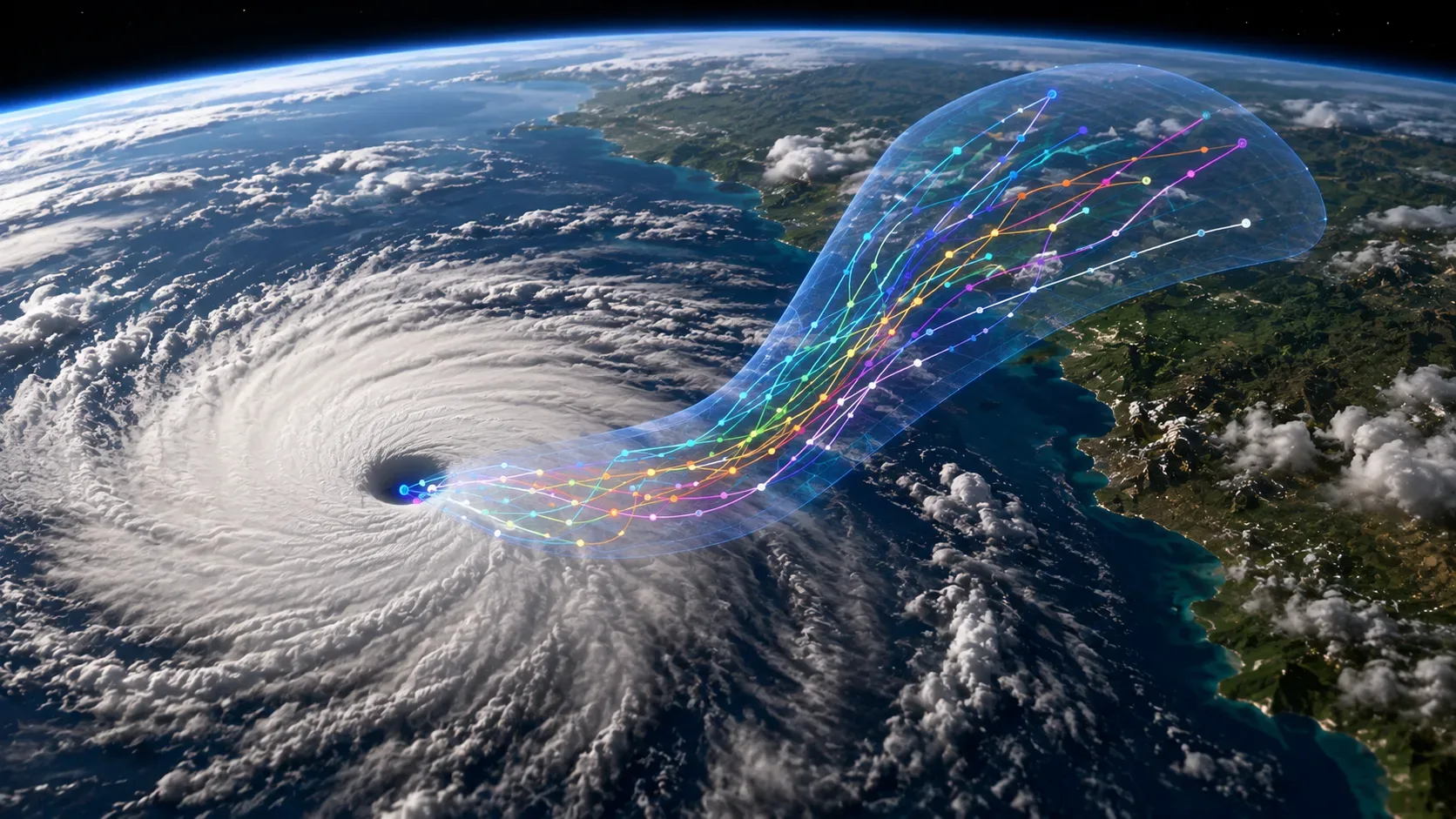
WeatherNext Cyclones are not just designed to deliver a unique trajectory. It can generate many plausible atmosphere and cyclone scenarios, forming an ensemble.
This difference is important because the operational decision rarely depends solely on where the center line is. A set of members allows you to ask, for example, which portion of the scenarios places a given region under winds of a specific intensity or how dispersed the possible trajectories are.
DeepMind displays ensembles of up to 1,000 members and probabilistic maps derived from these runs. The paper also works with smaller ensembles in regular evaluations. The idea is to better sample the distribution of results and, especially with larger sets, examine less frequent events.
This does not transform the thousand members into a thousand independent “votes” nor does it guarantee that the true scenario is among them. Nor should dispersion automatically be called an “official cone of uncertainty”: this type of operational product has its own definition by meteorological agencies.
The real gain is to allow evaluating the forecast also as a probability distribution, and not just by the distance between a predicted line and the observed trajectory.
Negative cases continue to exist
The supplementary results themselves avoid the interpretation of absolute superiority.
In the geographic decomposition of errors, WeatherNext Cyclones presents a predominant improvement over ECMWF ENS, but there are rare cases in which its trajectory or intensity error is substantially greater. Against HAFS, the trajectory advantage is more consistent; in intensity, the picture is more mixed, with a greater number of situations in which HAFS obtains a lower error.
The authors also apply bootstrap tests, resampling at the cyclone level, to verify in which time frames differences reach statistical significance. This strengthens the reading of the average result, but does not eliminate storm-to-storm variability.
Another limit appears in the structure of the winds. The radii of 34, 50 and 64 knots could be evaluated, but the RMW — maximum wind radius — was removed from the main verification because there were fewer observations and, consequently, less statistical power.
This is precisely where the phrase “predict cyclones one day in advance” starts to become too broad. The work measures several properties, with different data availability and references, and presents aggregated averages. It does not demonstrate that every characteristic of every cyclone is correct 24 hours in advance.
What has already appeared in the real operation
The model was not restricted to the laboratory. In 2025, forecasts from WeatherNext Cyclones were made available during the season, and documents from the National Hurricane Center show that DeepMind's guidance, identified as GDMI, was considered along with other models and consensus.
In Hurricane Melissa, for example, an NHC operational discussion noted a major GDMI shift between cycles, while other models also moved within the solution envelope. In other bulletins, the center combined or compared GDMI with HCCA, ECMWF, and HAFS to formulate the official forecast.
This is a sign of operational relevance, not process replacement. The model serves as another source of guidance in a decision that also considers other simulations, consistency between rounds, observations and meteorologists' judgment.
In an interview published by Wired on August 6, 2026, NHC director Mike Brennan reinforced this reading: additional hours may have practical value for preparation and evacuation, but no individual model is guaranteed to be the best in the next storm or the next season.
How to reproduce open model behavior
DeepMind published code, checkpoints and a demo notebook. There is, however, an essential distinction between seeing WeatherNext Cyclones working and reproducing the article's benchmark.
- Use the official repository and pin a version of the code, rather than automatically running the latest branch. The documentation itself warns that the search code may change and does not offer API stability.
- For an affordable demonstration, the official notebook uses the lower resolution WeatherNext Cyclones Mini by default, which can run on a v5e-1 TPU. It serves to inspect the prediction and tracking chain, but the documentation warns that its performance should not be considered equivalent to the larger models used in the paper.
- For scientific reproduction, choose the checkpoint compatible with the year evaluated. The repository maintains versions trained only on data from before the testing period — for example, models intended to reproduce results from 2023 or 2024 without using future data from that year.
- Keep the same initial state, observational truth and matching rules. The work uses IBTrACS for cyclone-specific verification and restricts homogeneous aggregates to the cycles available for all models in comparison.
- Separate deterministic and probabilistic metrics. Comparing just the ensemble mean measures one thing; evaluating the entire distribution with CRPS, energy score, reliability and probabilities measures another. Mixing the two readings produces wrong conclusions about what the system improved.
- When viewing multiple members, treat scatter as scenario distribution. To claim that the “extra day” was reproduced, it would still be necessary to recover the same cycles from the reference models and recalculate the error curves under equivalent conditions.
The most important point is not to use the Mini, get a visually plausible trajectory and conclude that the Nature benchmark was reproduced. Scientific testing requires the same time frame, correct checkpoints, baselines, observations and metrics.
So the WeatherNext Cyclones actually won a day?
As a benchmark summary, yes. As a universal operational promise, no.
The study presents evidence of a substantial and statistically relevant gain in different dimensions of cyclone forecasting, including wind trajectory, intensity and extent. In certain criteria, the difference clearly exceeds 24 hours. The ability to produce large ensembles also makes the model interesting for probabilistic predictions, not just for a central trajectory.
But the result comes from averages, homogeneous cuts, specific metrics and defined versions of the system. There are negative cases, differences between basins, observational limitations, and tracker changes. The benchmark was also produced by a group that includes DeepMind researchers and institutional collaborators; Scientific publishing increases scrutiny but is no substitute for independent replications and multiple seasons of operational verification.
When following the next WeatherNext Cyclones tests, it is worth always comparing which version was used, until when it was trained, against which model, in which basin, with which operational delay and by which metric. Without these qualifiers, “an extra day” is a good headline but an incomplete description of the outcome.